
Saint Lawrence River: Seaway Locks, Thousand Islands & Atlantic Inflow
Connecting the Laurentian Great Lakes to the Gulf of St. Lawrence, this 744-mile transboundary waterway drains 21% of the world's surface fresh water through a deep tectonic rift valley.
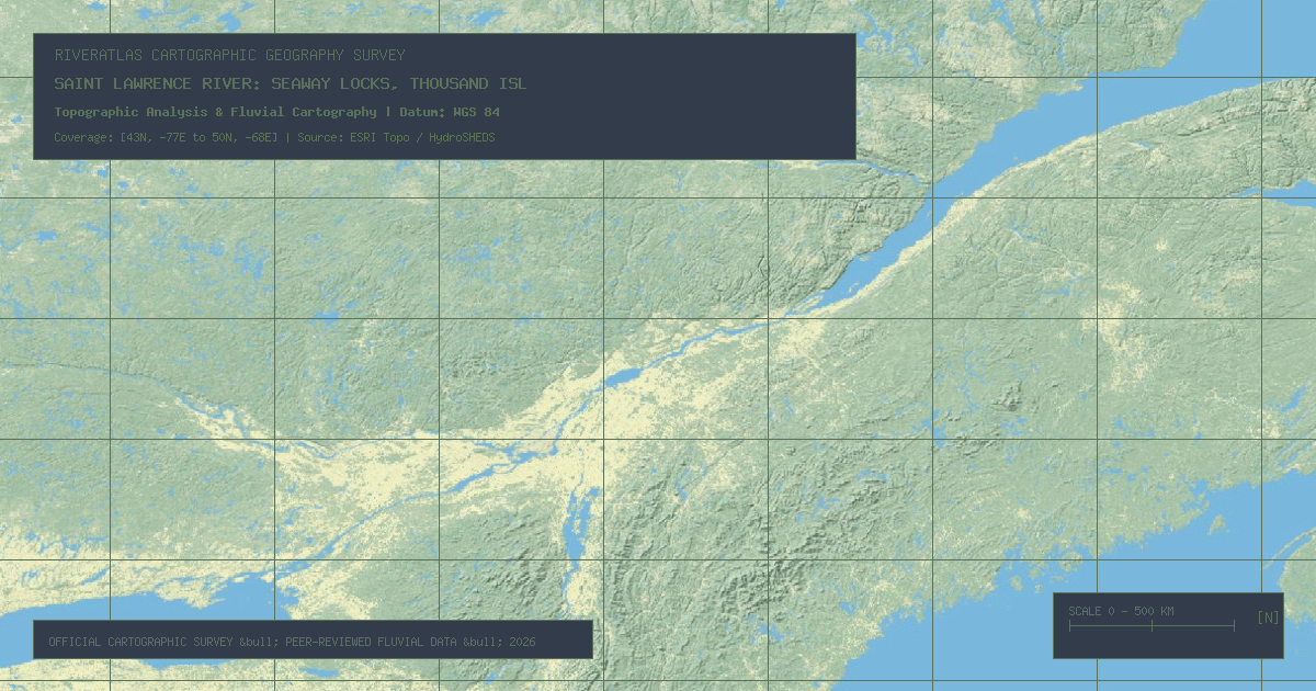
The **Saint Lawrence River** (*Fleuve Saint-Laurent*) is the hydrographic outlet of the North American Great Lakes. Flowing **744 miles (1,197 kilometers)** northeast from Lake Ontario to the Gulf of Saint Lawrence, it carves through Quebec, Ontario, and forms the international border with New York State.
### Draining the Great Lakes Basin
Because it drains Lakes Superior, Michigan, Huron, Erie, and Ontario, the St. Lawrence commands a watershed containing roughly **21% of all liquid surface freshwater on Earth**. It has an average volumetric outflow of **346,000 cfs (9,800 m³/s)** at its marine estuary near Tadoussac.
### The Saint Lawrence Seaway Engineering Feat
Completed jointly by the United States and Canada in 1959, the **St. Lawrence Seaway** revolutionized international maritime commerce:
- **System Elevation Lift:** Lifts ocean-going freighters 570 feet (174 meters) from sea level to Lake Erie.
- **Seven Giant Seaway Locks:** Including Snell and Eisenhower locks in New York, and Beauharnois locks in Quebec.
- **The Thousand Islands Region:** A drowned pre-Cambrian crystalline bedrock ridge connecting the Adirondacks to the Canadian Shield.
*Data Source: Saint Lawrence Seaway Development Corporation (SLSDC) & Canadian Hydrographic Service.*
Founder & Platform Administrator • The RiverAtlas Geographic Publishing Unit
Ammy Saini is the founder, chief administrator, and lead curator of The RiverAtlas (theriveratlas.info), directing global river hydrography, cartographic mapping datasets, and geographic publication integrity.
Related Geographical Research
Strahler Stream Order Explained: How Hydrologists Classify River Branches
A clear mathematical explanation of the Horton-Strahler topological hierarchy used in GIS cartography and watershed conservation.

How River Deltas Form: Arcuate, Bird-Foot, and Cuspate Coastal Geomorphology
A visual cartographer's guide to sediment deposition, wave energy equilibrium, and identifying the three principal deltaic landforms.
Understanding Drainage Basins and Watershed Divides: A Cartographic Guide
How topographers delimit river catchment areas using digital elevation models (DEMs) and why drainage basins are the natural unit for environmental management.