
Snake River: Hells Canyon Depth, Shoshone Falls & Lower Snake Dam Ecology
America's deepest river gorge cuts 7,993 feet into the basalt mountains of Oregon and Idaho along the 1,078-mile Snake River, center of the major Pacific salmon restoration controversy.
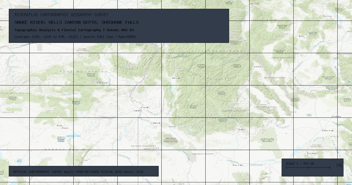
Originating at 9,500 feet elevation on the Two Ocean Plateau in Yellowstone National Park, Wyoming, the **Snake River** arcs **1,078 miles (1,735 kilometers)** across southern Idaho before cutting north along the Oregon-Idaho border and joining the Columbia River at Pasco, Washington.
### Hells Canyon: America\'s Deepest River Gorge
While the Grand Canyon is celebrated for its width and colorful layered strata, **Hells Canyon** on the Snake River is the deepest river gorge in North America:
- **Maximum Depth:** 7,993 feet (2,436 meters) from the summit of He Devil Peak in the Seven Devils Mountains down to the river surface.
- **Geological Composition:** Formed by the river carving through exotic accreted oceanic island-arc volcanic terranes uplifted alongside Columbia River flood basalt eruptions.
### Shoshone Falls & Salmon Migration Barriers
At Twin Falls, Idaho, the river plunges 212 feet (65 meters) over **Shoshone Falls**—a precipice 45 feet higher than Niagara Falls. For millenia, this massive cataract formed an impassable natural barrier, preventing Pacific salmon from reaching the upper 600 miles of the Snake River.
### The Four Lower Snake River Dams
Between Lewiston, Idaho, and the Columbia confluence, the federal government maintains four multi-purpose run-of-the-river dams: **Ice Harbor, Lower Monumental, Little Goose, and Lower Granite**. Environmental organizations, tribal nations, and fishery biologists advocate for breaching these dams to restore plummeting endangered chinook and sockeye salmon runs.
*Data Source: USGS Idaho Water Science Center & US Fish and Wildlife Service Pacific Region.*
Founder & Platform Administrator • The RiverAtlas Geographic Publishing Unit
Ammy Saini is the founder, chief administrator, and lead curator of The RiverAtlas (theriveratlas.info), directing global river hydrography, cartographic mapping datasets, and geographic publication integrity.
Related Geographical Research
The Ganges-Brahmaputra Delta: Dynamics of the World's Largest Estuary
How Himalayan tectonic erosion feeds a colossal delta of 105,000 square kilometers, nurturing the Sundarbans mangrove wilderness and the Bengal submarine fan.
The Seasonal Flood Pulse: How the Amazon and Mekong Sustain Global Biodiversity
Exploring the flood pulse concept in fluvial ecology, where the predictable annual rise and fall of river water drives evolutionary adaptations.
Colorado River Delta Desiccation: Tidal Restoration & Minute 323 US-Mexico Treaty
Once a two-million-acre lush riparian wilderness, the Colorado River Delta was completely desiccated by upstream dams until historic pulsed-flow restoration treaties.