
The Ganges-Brahmaputra Delta: Dynamics of the World's Largest Estuary
How Himalayan tectonic erosion feeds a colossal delta of 105,000 square kilometers, nurturing the Sundarbans mangrove wilderness and the Bengal submarine fan.
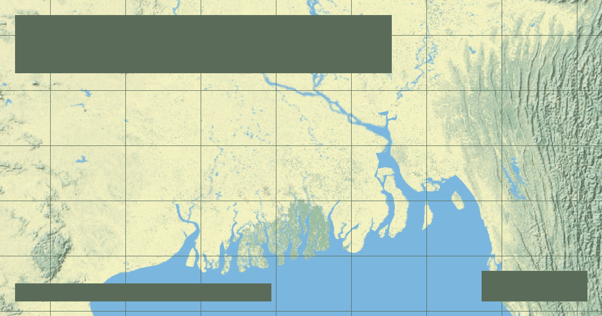
The **Ganges-Brahmaputra Delta**—spanning Bangladesh and West Bengal, India—is the largest fluvial delta on Earth, encompassing over 105,000 square kilometers. Formed by the confluence of the Padma (main Ganges branch), the Jamuna (lower Brahmaputra), and the Meghna, this massive sediment delivery system transports more than **one billion tons of Himalayan silt** annually to the Bay of Bengal.
### Sediment Dynamics and Island Creation (Chars)
The river channels within the delta are characterized by rapid braiding, avulsion, and the formation of transient silt islands known locally as *chars*. During the summer monsoon (June to September), glacial meltwater from the Tibetan Plateau combines with heavy monsoonal rainfall, submerging up to one-third of the lower delta.
### The Sundarbans: Ecological Buffer Zone
The seaward fringe of the delta hosts the **Sundarbans**, the largest contiguous tidal halophytic mangrove forest in the world. Dominated by the Sundari tree (*Heritiera fomes*), this UNESCO World Heritage ecosystem acts as a critical natural shock absorber against severe tropical cyclones arriving from the Indian Ocean, while supporting the world's only mangrove-adapted population of Bengal tigers (*Panthera tigris*).
Founder & Platform Administrator • The RiverAtlas Geographic Publishing Unit
Ammy Saini is the founder, chief administrator, and lead curator of The RiverAtlas (theriveratlas.info), directing global river hydrography, cartographic mapping datasets, and geographic publication integrity.
Related Geographical Research
The Seasonal Flood Pulse: How the Amazon and Mekong Sustain Global Biodiversity
Exploring the flood pulse concept in fluvial ecology, where the predictable annual rise and fall of river water drives evolutionary adaptations.
Snake River: Hells Canyon Depth, Shoshone Falls & Lower Snake Dam Ecology
America's deepest river gorge cuts 7,993 feet into the basalt mountains of Oregon and Idaho along the 1,078-mile Snake River, center of the major Pacific salmon restoration controversy.
Colorado River Delta Desiccation: Tidal Restoration & Minute 323 US-Mexico Treaty
Once a two-million-acre lush riparian wilderness, the Colorado River Delta was completely desiccated by upstream dams until historic pulsed-flow restoration treaties.